Szatymaz
Szatymaz is a village in Csongrád county, in the Southern Great Plain region of southern Hungary. The village lies 12 kilometers northwest of Szeged, neighboring Lake Fehér, a part of Kiskunság National Park. Szatymaz is accessible via the M5-Motorway, and by rail via Szeged-Budapest train lines, including the Intercity trains which pass through the village.
The area around Szatymaz has been inhabited since the early Bronze Age (2500–1700 B.C.). Archaeological remains of settlements dating from the time of the Pannonian Avars, and the early Kingdom of Hungary have been found in Szatymaz and its surroundings. The name "Szatymaz" likely derives from an old Cuman family name. Szatymaz was first mentioned in writing as a location on a 1676 Hapsburg map, which identified it as a postal stop between Szeged and Kistelek.
During the first half of the 18th century, inhabitants of Szeged bought land, and built small buildings around the postal stop to be used for agriculture and animal husbandry. These initial settlements soon developed into permanently inhabited farms, and grapes were cultivated. Vineyards bearing the names Ádokhegy, Neszűrjhegy and Szűcsök hegye were established. Following the completion of the Szeged-Budapest railway in 1854, the vineyards of Szatymaz became a popular vacation spot for Szeged's middle class, some of whom even built villas there, which are no longer standing. Following this settlement, today's village of Szatymaz took shape, and in 1902 the village church was constructed using donations from locals.
In the August of 1919, following the Hungarian Soviet Republic's 131-day reign of terror which left over 500 dead, 10 Jewish communists were publicly hanged in Szatymaz under the command of Pál Prónay, and one was shot by general Bibó Dénes.
Map - Szatymaz
Map
Country - Hungary
 |
 |
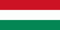
| Flag of Hungary | |
The territory of present-day Hungary has for centuries been a crossroads for various peoples, including Celts, Romans, Germanic tribes, Huns, West Slavs and the Avars. The foundation of the Hungarian state was established in the late 9th century AD with the conquest of the Carpathian Basin by Hungarian grand prince Árpád. His great-grandson Stephen I ascended the throne in 1000, converting his realm to a Christian kingdom. By the 12th century, Hungary became a regional power, reaching its cultural and political height in the 15th century. Following the Battle of Mohács in 1526, it was partially occupied by the Ottoman Empire (1541–1699). Hungary came under Habsburg rule at the turn of the 18th century, later joining with the Austrian Empire to form Austria-Hungary, a major power into the early 20th century.
Currency / Language
| ISO | Currency | Symbol | Significant figures |
|---|---|---|---|
| HUF | Hungarian forint | Ft | 2 |
| ISO | Language |
|---|---|
| HU | Hungarian language |


